Future Plans/Progress to date
| Detailed Design |
|
All the necessary surveys and detailed design work
for Stages 1 and 2 of the build - the complete
York Stream arm, including the weir - were completed in 2015 after securing plannig consent in 2012. RBMW then tendered, funded and
has contracted the bulk of the work to date.
Greenford Ltd
undertook this stage of the build, with the
central Stage 1 area completed in mid 2016 and Stage 2 during 2017. Flow was temporarily diverted into Moor Cut to allow the
channel works, but returned to the York Stream in January 2018. The weir was then tendered and built in 2020 after approval of an
impoundment licence by the Environment Agency. Completion of the weir in February 2020 has lifted and stabilised water levels throughout the town
centre, filling the already enlarged upstream channels. With the flow returned to York Stream, the unchanged Moor Cut now has no regular flow but
is partly backfilled from the weir pool.
|
| Implementation |
|
FoMW’s planning consent for Phase 1 was valid for five years, with a further five
years allowed to complete the consented works.
Work on site commenced in July 2015, so our inital
consent was valid until June 2020. Implementtaion of further stages will now require additional consents. Funding the £10-12m total
build costs of the ‘Ring’ poses a major challenge and
the build is planned in stages, in conjunction with the streamside Area Action
Plan developments which stand to benefit from gaining an enhanced waterside
setting. |
| Stages 1 and 2 |
|
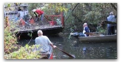
With the benefit of a £1.6m interest free LEP Growing Places loan and with the Shanly plans also proceeding, tree clearance for implementation of the waterways consent commenced in 2014, with work on site for the £2m Stage 1 - the highly visible A4/St Cloud to Great Western Railway section of York Stream - starting in July 2015. Funding for the £3m Stage 2 of the build was agreed in December 2015 and this stage of works - including the weir - has also now been completed, with further enhancements also added. |
| Next Steps |
|
With the Chapel Arches and York Stream plans largely complete FoMW's attention is turning to Stage 3 of the build - Moor Cut - and how the waterway can best interact with other Area Action Plan developments in the pipeline or envisaged in the emerging Borough Local Plan. The RBWM owned land on the west of York Stream near the Library and also in the Reform Road estate adjoining Moor Cut both have the potential to help fund implementation of further stages of the waterway. |
| Bray Cut |
|
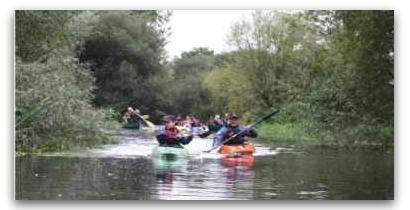
Per FoMW’s agreed priorities, we are also seeking opportunities to open up the southern channel which already links the ‘Ring’ to The Thames at Bray Marina. This channel was enlarged in the 1960s as part of the town’s flood defences, but has silted up since and is very overgrown. The Jubilee River has replaced its former flood role, allowing it to focus on amenity use and as a haven for wildlife. Bray Cut continues to have a Public Right of Navigation, which cannot be extinguished by lack of use, and remains popular with canoeists. Restoring this southern section of the overall waterway route for larger boats is more complicated and may need further planning permission, but will also need significant tree work and the channel bed dredged, with sensitive handling from an environmental perspective. |