Habitat and Wildlife
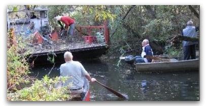
The habitat of the area where the streams currently flow is typical of the Thames Valley area, with a wide variety of vegetation and wildlife. Restoring and enhancing the waterways will inevitably cause some disruption to wildlife, but the Environmental Impact Assessment supporting the Phase 1 plans concludes that any adverse impacts will be limited and temporary. Mitigation will further reduce any residual adverse impacts. When the scheme commences, the restoration work will be done in stages, allowing one part to recover as the area of works moves onward to a new section. A Construction and Environmental Management Plan will ensure that wherever feasible, construction work is done at the optimum times of year, to lessen disturbance to wildlife e.g. by avoiding work on sensitive areas during the nesting season.
York Stream to the Confluence with Moor Cut at Green Lane
 This section forms part of the Phase 1 'Ring' works and includes the
most urban part of the channels, where both York Stream and the Moor Cut pass through the
town centre. Moor Cut was enlarged in the 1960s as part of Maidenhead's flood defence system,
but is presently dry. Its flood role has been overtaken by the much larger Jubilee River
scheme.
This section forms part of the Phase 1 'Ring' works and includes the
most urban part of the channels, where both York Stream and the Moor Cut pass through the
town centre. Moor Cut was enlarged in the 1960s as part of Maidenhead's flood defence system,
but is presently dry. Its flood role has been overtaken by the much larger Jubilee River
scheme.
The channels split at Town Moor just above the Police Station and join up again at Green
Lane, where a lock, boat rollers, fish pass and weir are planned. The lock will only be
built when the size of boat able to reach the Ring justifies this.
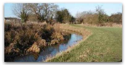
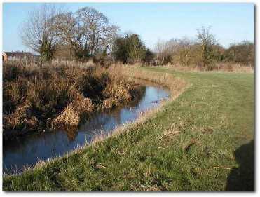
The channels vary in character but for the most part the riverbanks on both
sides are natural. The
vegetation is generally rough and unmanaged, mainly comprising nettles, brambles, dock,
white umbellifers and bind weed. River channel vegetation varies considerably with the
water conditions, from semi improved grassland at the top of Moor Cut to marshy herb and
weed further downstream.
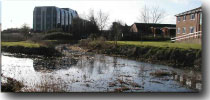
The Waterway Today
 The waterways route is today a mix of minor streams, dry or neglected
channels that are overgrown, silted up and a shadow of their former selves.
The waterways route is today a mix of minor streams, dry or neglected
channels that are overgrown, silted up and a shadow of their former selves.
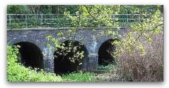
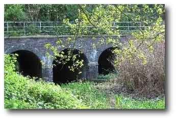
York Stream and the connecting Moor Cut channels are heavily silted up and overgrown, yet
they still possess some impressive bridges built in the days when both streams were much
larger than today. On the left we see part of Brunel's four arch brick built
tunnels where York
Stream passes under the main GWR railway line. A similar sized set of four arches straddles
the hidden Moor Cut channel just above Forlease Road.
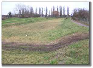 Moor Cut
passes over Town Moor, under the dual carriageway and beneath the old A4 Bath Road,
just behind Waitrose's car park. Since the Jubilee River flood relief was constructed it is
normally dry (see left) and its 1960s flood protection role has been overtaken.
Moor Cut
passes over Town Moor, under the dual carriageway and beneath the old A4 Bath Road,
just behind Waitrose's car park. Since the Jubilee River flood relief was constructed it is
normally dry (see left) and its 1960s flood protection role has been overtaken.
The Northern Section
 The Northern section of the route is not part of the current planning
consent but would be part of a future phase of the waterways plans, running from the Thames
near Cliveden Reach down to the York Stream/Moor Cut diffluence at Town Moor behind the
Police Station where the Phase 1 Ring commences. The exact route is subject to further
review, but will probably start near Cliveden Reach, passing through White Brook and
joining Maidenhead Ditch by Town Moor. The habitat on the river bed here varies from
emergent reeds, rushes and sedges to semi improved grassland, with the river channel
providing a wildlife corridor through largely agricultural land.
The Northern section of the route is not part of the current planning
consent but would be part of a future phase of the waterways plans, running from the Thames
near Cliveden Reach down to the York Stream/Moor Cut diffluence at Town Moor behind the
Police Station where the Phase 1 Ring commences. The exact route is subject to further
review, but will probably start near Cliveden Reach, passing through White Brook and
joining Maidenhead Ditch by Town Moor. The habitat on the river bed here varies from
emergent reeds, rushes and sedges to semi improved grassland, with the river channel
providing a wildlife corridor through largely agricultural land.
Much of the proposed route would impact upon arable land which is of little ecological
value, but some short term adverse impact on vegetation and wildlife elsewhere along the
route will be unavoidable during the works. The consented plans for the town centre
Ring include a number of mitigation steps to offset and minimise any unavoidable adverse
ecological impacts.
The Southern Section
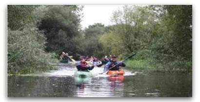
The waterway below Green Lane is known as Bray Cut and is already quite wide (12-14m)
along most of its length, with natural banks and overhanging trees. It is a haven for
wildlife, with Kingfishers and swans seen in the area. The channel passes the site
proposed for the new Oldfield school, which would sit between Bray Road and the waterway.
If the school plans proceed, MW has proposed that a footbridge over the waterway be included,
offering pupils and residents a safe walking route directly into Braywick Park and the Nature
centre.
Immediately below the school site, the waterway passes the sensitive Site of Special Scientific
Interest (SSSI) known as Bray Meadows which contains a rare form of field grass. Natural
England did not raise any objection to our Phase 1 planning consent, but will take a close
interest in the works needed to deepen the Bray Cut channel to provide access for boats from
The Thames next to Bray Marina.
Some parts of the Southern channel are overgrown, silted up or partly blocked with reeds
in summer months. Our plans have yet to be refined for this section of the waterway, but
are likely to involve relatively minor clearance works, focused on dredging and tree clearance.